The violent eruption of an underwater volcano near Tonga on January 15 spawned a 4-foot tsunami. It also resulted in an ash cloud 12 miles high.
Tonga is located about 2,000 miles (3,300km) east of Australia. The volcano consists of two small uninhabited islands, Hunga-Ha’apai and Hunga-Tonga. On Saturday, the center of the volcano sank, disappearing under the sea. But after about two hours, it erupted. The eruption was so massive that its shock-waves were felt as far away as Mount Hood in Oregon. After the eruption, almost all of the volcano and the land around it had disappeared.
The eruption resulted in a severe tsunami on Tongatapu, where the capital is located. As a result, several feet high waves hit Australia, New Zealand, and Japan as well as the west coasts of North and South America.
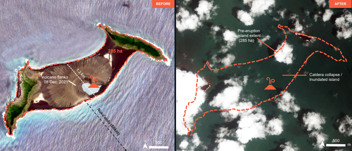
Satellite imagery shows absolute devastation
Earlier it was speculated that the blast had expanded the island where the Hunga Tonga volcano is located. But new imagery from the United Nations Satellite Centre has revealed a different reality. Damage from the eruption was so severe that just small parts of the island are now visible from above.