Scientists have uncovered a vast, thousand-mile-long river hiding below the frozen cover of the Greenland. The subterranean river is thought to transport water from central region of Greenland to the northern coast.
Researchers from Hokkaido University, a Japanese national university and the University of Oslo mapped the bedrock beneath Greenland. They presented their study at the American Geophysical Union (AGU) annual meeting. Researchers created computer simulations to explore the valley at different depths. This way they were able to survey the valley and discover how the river might’ve been created by glacial melt.
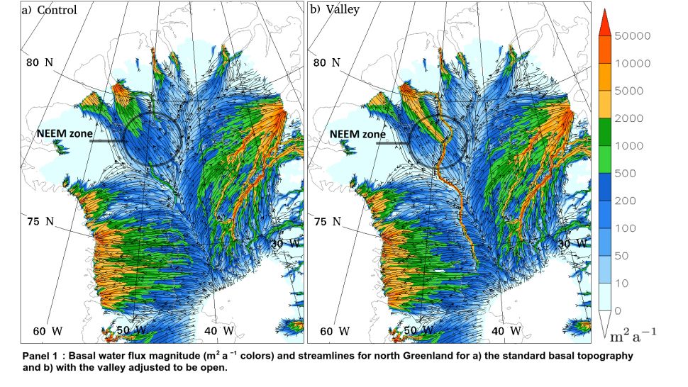
Christopher Chambers, a researcher at Hokkaido University explained that the results from Radar maps showed that the valley floor was extremely level at depths of 980 feet and 1,640 feet (300 meters and 500 meters) below the surface. He clarified that this feature is highly unusual for such a long stretch. So it could either be a spot with active erosion or sediment deposition, such as a river.
Researchers initially modeled the valley digitally and then removed the blocks of missing data. When researchers digitally filled in the gaps in the radar images of the valley, they simulated a river flow in the valley.
Author of the study, Christopher Chambers from Hokkaido University explained, “Eventually if you get it deep enough — minus 500 meters [1,640 feet] — the water is now flowing the entire length along the valley and then exiting at Petermann Fjord.”