Did you know that about one-third of the Netherlands lies below sea level? Netherlands’ three largest cities (Amsterdam, Rotterdam, and The Hague) lie in these low-lying regions. Because of this, flood control is an important issue for the Netherlands.
In the waterlogged Netherlands, the Dutch have successfully managed to build sea defenses to push backwater.
For Dutch climate- change is not a setback, instead, it’s an opportunity
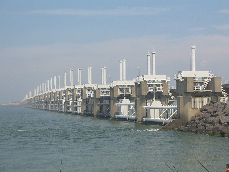
To protect their country, the Dutch used many ways to protect them from floods like Polders and Afsluitdijk.
Polders are areas lying below sea level, which were reclaimed through the building of dikes, drainage canals, and pumping stations. Over time, over 3,000 polders were created throughout the nation.
Afsluitdijk is a causeway that wall off the Zuiderzee from the North Sea, and created a freshwater lake called the Ijsselmeer. Afsluitdijk stretches 20 miles (32 km) across the water with a final height of 23 ft (7 m) above sea level. It was built by depositing boulder clay from the bottom and was topped off by sand and clay. It was then held together by grass.
The Dutch skill is not only helping them deal with their problem, but they are also selling their engineering expertise worldwide. The Dutch are famous for their mastery of coastal engineering and water management, which has kept them safe for centuries.


