NASA has a new project underway called GEDI. The sole purpose of GEDI is to point a laser-based device at Earth from the International Space Station in order to map out forests in 3D, eventually determining the amount of carbon in Earth’s forests.
Ralph Dubayah, GEDI principal investigator at the University of Maryland, said in a statement, “One of the most poorly quantified components of the carbon cycle is the net balance between forest disturbance and regrowth. GEDI will help scientists fill in this missing piece by revealing the vertical structure of the forest, which is information we really can’t get with sufficient accuracy any other way.”
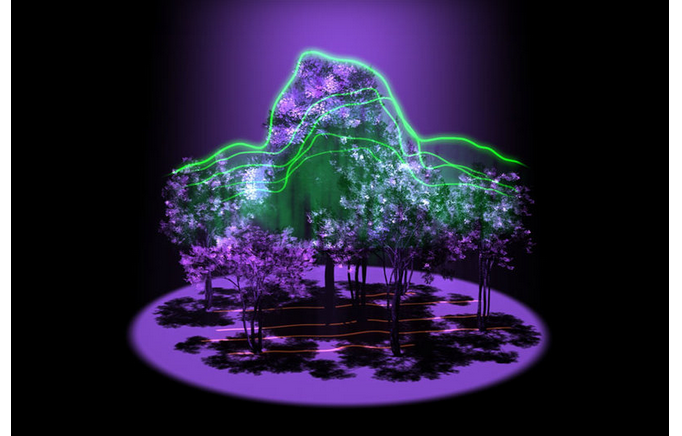
GEDI, or Global Ecosystem Dynamics Investigation, will utilize lidar technology in order to create the 3D maps. The process uses laser pulses in association with light to bounce off the Earth’s surface and back to the laser to determine topography based on the distance and also the time it takes for the laser pulses to return.
NASA is planning on sending out an incredible 16 billion pulses a year, providing measurements accurate enough to determine a tree canopy’s height within 3 feet.
GEDI deputy principal investigator Bryan Blair said, “Lidar has the unique ability to peer into the tree canopy to precisely measure the height and internal structure of the forest at the fine scale required to estimate their carbon content.”
At the moment, GEDI is expected to launch in 2018.