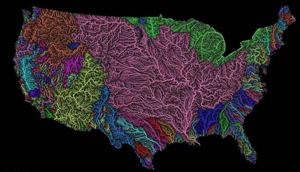
A colorful high-resolution map displays all the river basins in the 48 contiguous U.S. states.
The incredibly detailed map was created by the Imgur user Fejetlenfej, also known as Robert Szucs. Map maestro Szucs is a geographer and GIS analyst. The map captures the flowing glory of all the major river basins in the U.S. in different colors.
Szucs created the map using the open-source QGIS software with data created by the U.S. Geological Survey. Quantum GIS (QGIS) is a user-friendly open-source geographic information system (GIS).
The longest river on the map is the Missouri at 2,540 miles. But the largest in terms of water volume is the Mississippi. The map captures the massive Mississippi River’s contributing basins beautifully in pink.
You can buy prints of this beautiful informative map online from Szucs’ Etsy shop.